


CU GeoData: The World In Our Hands
WHO ARE WE?
CU GeoData is a new student-run project team at Cornell which designs, builds, and deploys instrumentation capable of recording a large variety of atmospheric, geologic, and hydrologic data. We plan to partner with a number of different organizations, both private and governmental, to provide accurate environmental data. Some of our current projects involve improving harmful algal bloom monitoring in Cayuga Lake and deploying unique payloads on atmospheric weather balloons. As a whole, CU GeoData allows students from a diverse set of majors and programs to make important contributions to data collection and scientific understanding.
MEET OUR TEAMS
AIR TEAM
The air team is responsible for tackling atmospheric chemistry and air quality data as well as improving weather balloon payloads and instrumentation. We currently are undertaking two main projects: Finger Lakes forecasting via tethersonde and atmospheric chemistry.
Designing the Tethersonde
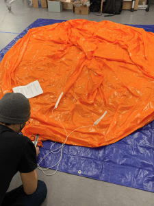
The first project involves the use of tethersondes, which are radiosondes attached to balloons that move upward and downward at a fixed location that measure atmospheric upper air data for the Finger Lakes region. All data collection will enhance understanding of surface friction on different atmospheric variables, mainly as a means of improving weather forecasting in the Ithaca area. This will aid in providing reliable and accurate meteorological forecasting for south-central New York. Because the nearest tethersonde is located in Buffalo, soundings taken there would not correctly predict variables in the Ithaca due to topographical differences (e.g., gorges, ridges, creeks, and lakes), so analyzing the local low-level environment will be important to understand the near-Ithaca boundary layer and how this will be proven useful to future weather forecasts. On the left image, Sam Jurado, member of the Air Team, designs the tethersonde.
Atmospheric Chemistry
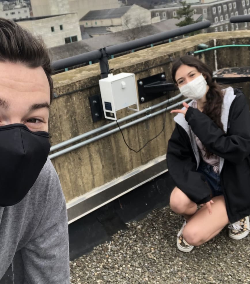
The later project, atmospheric chemistry, aims to install a network of monitoring stations whose main objective centers on gathering measurements of local pollutants and their precursor quantities (e.g., ozone, nitrous oxides, and particulate matter). These measurements will prompt investigations of possible health risks, topographic features inhibiting pollutant dispersion, and expected meteorological condition-dependent pollutant persistence by combining this data with those from weather stations at the Ithaca Airport and Game Farm Road on Cornell's main campus. The photo shows the deployment of the atmospheric sensor atop Snee Hall on Cornell's campus.
ROCK TEAM
The rock team is responsible for measuring and monitoring the quality and stability of soil in our region. Microorganism biodiversity, erosion resistance, agricultural productivity, and conservation of the water table highly depend on soil stability, which is dependent on soil moisture. The rock team will be responsible for constructing three self-sustaining soil moisture instruments adapted from FreeStation and RaspberryPi builds. Members will then profile basic changes of surface soil under a multitude of moisture conditions through x-ray deflection (XRD).
The rock team's planned studies are:
1. Silt loam samples (topsoil) varying in organic matter will be collected to determine whether mineral changes are dependent on organo-mineral interactions resulting from soil moisture modifications
2. Changes in mineralogy will be done through spectroscopic analysis, such as X-ray fluorescence spectrometry (XRF) or other useful methods.
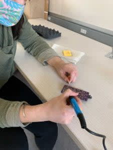
On the upper left, rock team member Yasamin Bayley solders the freestation.
WATER TEAM
Members of the water team are currently developing a sensor that aims to collect water quality data to understand the origins of harmful algal blooms (HABs), which have produced toxins capable of threatening water usage for drinking and recreation in Cayuga Lake. The sensor will monitor water properties that could potentially serve as a cause for HABs, in conjunction with satellite imagery following this primary data collection.
The sensor is modeled after the Smart Rock sensor, which is capable of measuring several variables, such as water depth, temperature, turbidity, and salinity. They are then assembled and placed inside of PVC and submerged in a body of water. The complete sensor will test Cayuga Lake where water enters it and where there has been a history of harmful blooms. Lastly, it is expected the sensor will be used to measure contents of nitrogen and phosphorus, which may be potential instigators for HABs.
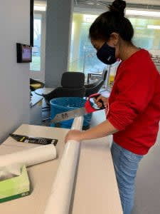
On the upper right, water team member Faima Quadir saws PVC for water sensor enclosure.
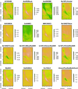
Remote Sensing HABs
The second project is harmful algal blooms remote sensing, which focuses on retrieving satellite data to produce images of present HABs in Cayuga Lake by using software in R (a programming language) called "waterquality". The images will give members information regarding color, size, and extent of the HABs, with the former currently being created along with all other images using Sentinel 2 satellite data.
Shown on the right are images of Cayuga Lake's harmful algal blooms using different waterquality systems.
BUSINESS TEAM
 The business team meeting virtually to discuss sponsor outreach
The business team is the backbone of CU GeoData — we are responsible for promotional material, budgeting requirements, website management, and supply purchasing. Specifically, the business team is responsible for planning yearly and semester budgets, creating and maintaining sponsorship relations, designing and managing our website with tools like Canva, and working with our Outreach Lead on science communication regarding environmental and project focused blog posts.
TECH TEAM
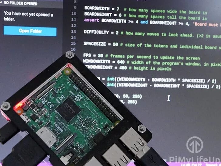 The tech team works on coding the data collected from our sensors and equipment as shown above
WE ARE EXTREMELY THANKFUL FOR YOUR SUPPORT AND GENEROSITY TOWARDS OUR MISSION!

$10
2 Small Raspberry Pi's
This donation will allow us to purchase two small Raspberry Pis, which help our Tech Team perform coding and programming tasks to assist other subteams.
$20
Aquatic Sensor Tools
This donation will allow our Water Team to construct and maintain aquatic sensors which currently monitor algal blooms in Cayuga Lake.
$50
Serial Telemetry Radio Kit
This donation will allow our Air Team to purchase a serial telemetry radio kit, which helps us communicate with weather balloons while they monitor and research air conditions.
$100
2 Hard Drives
This donation will allow our Tech and Business Teams to purchase two hard drives to store data and analytics from our atmospheric, aquatic, and geological instruments.
$250
CO2 Sensors
This donation will allow our Air Team to purchase and engineer carbon dioxide sensors on Cornell’s campus to collect better emissions data about the Fingerlakes Region.
$500
Hose Motors + Team Endorsement
This donation will allow our Air or Rock team to collect more precise data by purchasing Hose Motors which attach to atmospheric or geological instruments. This level of sponsorship will also come with an endorsement on our website and social media channels.